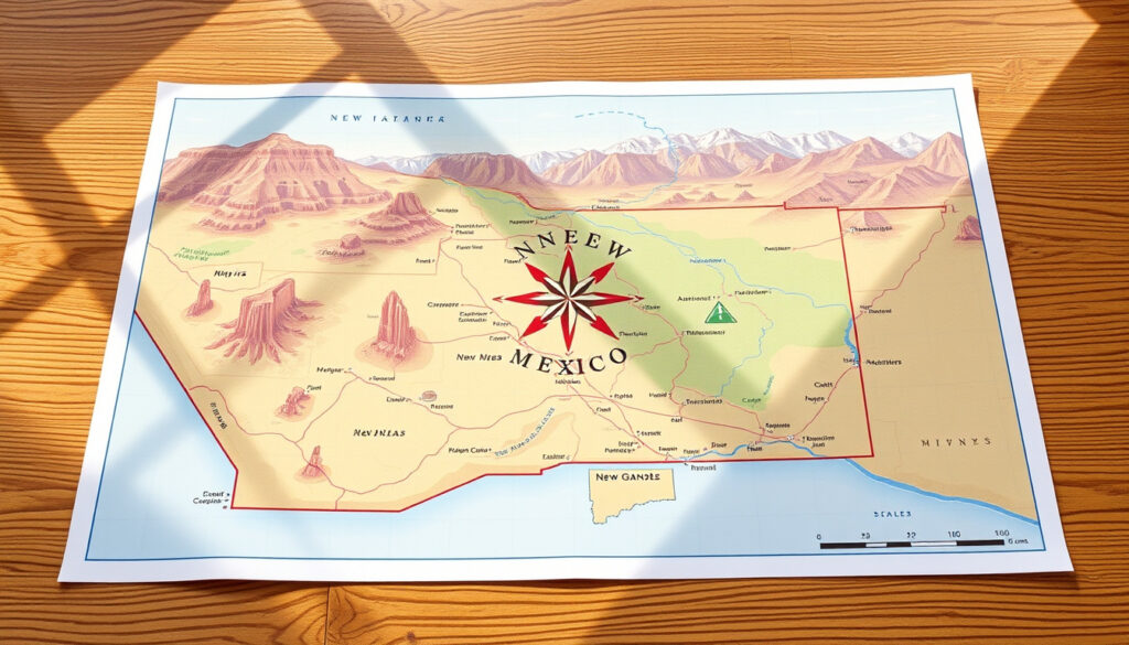
Map of New Mexico – Official Interactive and Printable Resources
New Mexico spans 121,590 square miles in the American Southwest, sharing borders with Arizona, Oklahoma, Texas, Utah, and Mexico. The state offers extensive mapping resources through official state agencies, federal organizations, and regional portals. These resources cover everything from major highway networks to topographic terrain, county boundaries, and tourist attractions.
Whether planning a road trip along Interstates 25 and 40, researching county boundaries, or locating national parks and monuments, the available maps range from simple reference documents to fully interactive digital platforms. This guide consolidates the most useful mapping resources and explains what each type of map reveals about the Land of Enchantment.
What Cities and Key Locations Are on a Map of New Mexico?
New Mexico contains 33 counties and a population spread across urban centers and rural communities. The most prominent city is Albuquerque, home to roughly 560,000 residents in Bernalillo County. Santa Fe, the state capital, sits in the north-central region and serves as a cultural and governmental hub. Las Cruces in Doña Ana County represents the second-largest metropolitan area, while Rio Rancho and Hobbs round out the major population centers.
Smaller communities visible on regional maps include Alamogordo, Roswell, Farmington, and Clovis. Each appears on base maps organized by population classification—typically showing places with more than 10,000 residents as distinct labeled points, with smaller towns marked proportionally.
- Albuquerque serves as the primary economic center, located where Interstate 25 meets Interstate 40
- Santa Fe lies approximately 65 miles northeast of Albuquerque along Interstate 25
- Las Cruces sits near the Texas border on US 70 and Interstate 10
- The state contains 33 counties, each with a designated county seat
- Northern New Mexico includes numerous Pueblo communities, including Acoma and Cochiti
- Carlsbad Caverns National Park represents the state’s most visited national site
| Feature | Details | Typical Map Reference |
|---|---|---|
| Major Cities | Albuquerque, Santa Fe, Las Cruces | Central and southern regions |
| Interstate Highways | I-25, I-40, I-10 (partial) | North-south and east-west corridors |
| County Count | 33 total counties | All regions with labeled boundaries |
| Elevation Range | Below 3,000 ft to over 13,000 ft | Northern mountains and southern basins |
| Bordering States | Arizona, Oklahoma, Texas, Utah | West, northeast, east, northwest corners |
| Bordering Country | Mexico (Mexican states of Chihuahua and Sonora) | Southern boundary |
How to Access an Interactive Map of New Mexico
Several official portals provide real-time interactive mapping for New Mexico. The New Mexico Department of Transportation maintains an ArcGIS Online map gallery accessible via standard web browsers on computers, tablets, and mobile devices. This platform displays road conditions, traffic camera feeds, construction zones, weather advisories, and rest area locations through the NMRoads interface.
For geospatial data and GIS analysis, the New Mexico GIS Bureau offers coordinate-based resources useful for geographic research and planning. The NM State Land Office provides interactive maps covering GIS datasets, outdoor recreation sites, and downloadable spatial information. Their office can be reached at 505-827-5760 for specific data requests.
National and Federal Interactive Resources
The BLM publishes georeferenced PDFs tailored for National Conservation Lands throughout New Mexico. These files align with GPS coordinates and mapping software, making them suitable for backcountry navigation.
The New Mexico Tourism Map Explorer provides an interactive platform highlighting Pueblo communities, state parks, and connections to national sites. Users can explore specific regions and access details about attractions, campgrounds, and visitor services.
The NMDOT interactive portal works on Chrome, Edge, and other standard browsers across mobile devices. For offline access, download county-specific PDFs before traveling through areas with limited connectivity.
Printable and Downloadable Maps of New Mexico
Free printable maps are available from multiple official sources. The NMDOT offers a state road map PDF covering highways, major cities, and regional connections. The milepost map, approximately 59 MB in file size, provides detailed highway segment information useful for trip planning and logistics.
The NM State Library maintains digital topographic maps in 7.5-minute quadrangle format with a zoom and search interface. These USGS-derived maps depict elevation contours, water features, trails, and man-made structures. Some files are available free for download, while others require library access or purchase through the Public Lands Information Center.
Topographic and Reference Downloads
The University of Texas Map Library hosts extensive New Mexico cartographic collections including shaded relief maps with boundaries, forests, and highways. Available formats include:
- 1:2,500,000 base maps from 1972 and 1990 editions
- National Atlas maps from 2001 and 2002
- Federal Lands and Indian Reservations maps from 2003
- City-specific topographic quads such as Alamogordo (1:24,000 scale, 1981) and Roswell (1:24,000 scale, 1962/1985)
File sizes range from small JPEGs suitable for quick reference to multi-megabyte PDFs offering high-resolution detail. Before downloading large files, verify your device storage capacity and connection speed.
Major Highways and Road Maps of New Mexico
Two interstate highways form the backbone of New Mexico’s road network. Interstate 25 runs north-south through the state, connecting Las Cruces, Albuquerque, Santa Fe, and continuing toward Colorado. Interstate 40 travels east-west across the central portion, passing through Albuquerque, Moriarty, and Tucumcari before entering Texas.
U.S. highways supplement the interstate system, including US 70 through Clovis and Roswell, US 550 connecting Albuquerque to the Four Corners region, and US 160 near the Arizona border. State roads provide access to rural communities and recreational areas throughout the state.
The NMDOT map portal includes functional classification maps showing highway categories by traffic volume and highway type. The Environmental Protection Agency regional map displays cities and towns classified by population brackets alongside the classified highway system.
Road Condition Resources
The NMRoads system integrated into the NMDOT portal provides real-time road condition updates. This service covers construction zones, weather-related closures, and camera feeds from major intersections. Travelers planning routes through mountain passes or desert corridors should check current conditions before departure.
Road work throughout New Mexico typically intensifies during spring and summer months. Monitor NMDOT advisories for detours and lane reductions, particularly along I-25 between Santa Fe and Albuquerque.
New Mexico Counties and Regional Maps
New Mexico contains 33 counties, each with distinct geography, communities, and administrative boundaries. County maps display the extent and neighboring jurisdictions for each area. The state includes three northern counties—Rio Arriba, Taos, and Mora—that feature mountainous terrain and numerous small communities, while southern counties like Chaves and Eddy consist largely of Chihuahuan Desert landscape.
Base and outline maps available through the UT Library collection show county boundaries, names, and county seats. These maps vary in scale from statewide overviews to detailed county-level sheets useful for local navigation.
The GIS Geography resource provides a New Mexico-specific map showing cities, roads, rivers, and lakes alongside county boundaries. This consolidated view helps users understand how populated areas relate to geographic features and regional divisions.
Physical Features and Tourist Maps of New Mexico
Physical maps of New Mexico reveal dramatic elevation changes across the state. The northern region includes the Southern Rocky Mountains, with Wheeler Peak—the highest point in the state—rising to 13,167 feet above sea level. Central New Mexico features the high desert plateau where Albuquerque sits at approximately 5,300 feet elevation. The southern portion drops into the Chihuahuan Desert basin.
Topographic maps from the USGS and NM State Library illustrate these elevation changes through contour lines. The 7.5-minute quadrangle series provides detailed terrain representation for specific areas, useful for hiking, climbing, and geological study.
Tourist Attractions and Recreation Areas
State and national tourist attractions appear on dedicated mapping platforms. The NM Tourism Map Explorer identifies Pueblo communities including Acoma and Cochiti, state parks such as Bluewater Lake and Bottomless Lakes, and connections to national monuments and parks.
The Four Corners regional PDF covers attractions near the state intersection with Arizona, Colorado, and Utah. This document references USGS and National Park Service sources for accuracy.
Federal land management maps from the BLM and Forest Service detail recreation opportunities on public lands, including trails, campgrounds, fishing lakes, and visitor centers. Those planning camping trips might find our camping equipment guides useful for preparing outdoor adventures.
A Brief History of New Mexico’s Maps and Boundaries
Cartographic representation of New Mexico has evolved significantly since Spanish colonial exploration. Early Spanish maps depicted the region as part of the larger province of Santa Fe de Nuevo México. Following American acquisition through the Compromise of 1850, official surveys began documenting county boundaries and transportation routes.
- 1598 — Spanish explorer Juan de Oñate formally establishes settlements along the Rio Grande, creating earliest regional cartographic records
- 1848-1850 — Following the Mexican-American War, the Territory of New Mexico is organized with defined boundaries with Utah and Arizona territories
- 1912 — New Mexico becomes the 47th state, finalizing the rectangular shape with Oklahoma’s panhandle to the east
- 1930s-1940s — Civilian Conservation Corps and USGS complete detailed topographic mapping of northern mountains and desert regions
- 1990s-2000s — Digital GIS systems replace paper maps for state planning and transportation management
- 2020s — Interactive web portals and mobile applications now provide real-time mapping with live traffic and weather data
What We Know for Certain Versus Common Misconceptions
| Confirmed Information | Common Misconceptions |
|---|---|
| New Mexico borders four U.S. states plus Mexico | Some believe New Mexico borders only Arizona—it actually shares boundaries with Arizona, Oklahoma, Texas, Utah, and Mexico |
| The state uses the landlocked designation correctly | Confusion exists about ocean access—New Mexico has never had coastal territory despite regional geography discussions |
| Santa Fe is the capital and has been since early statehood | Some visitors assume Albuquerque is the capital due to its size—Santa Fe has served as the administrative center since Spanish colonial times |
| The Four Corners monument sits at the intersection of four states | Technical survey adjustments have slightly shifted the official monument location from the true mathematical intersection point |
| Interstate 10 enters New Mexico briefly near Lordsburg | Travelers sometimes assume I-10 crosses through central New Mexico—it only touches the southwestern corner |
Understanding New Mexico’s Geography Through Maps
Maps reveal New Mexico’s position as a transitional zone between the Rocky Mountains and the Chihuahuan Desert. This geography creates distinct regional divisions that influence travel routes, economic activity, and cultural identity. The northern mountains receive significantly more precipitation than the southern basins, a pattern visible on physical maps through vegetation indicators and watershed boundaries.
Whether using paper reference maps or real-time digital platforms, understanding how to read and access these resources transforms the way one experiences the Land of Enchantment. From the high-desert corridors of the central plateau to the alpine meadows of northern peaks, New Mexico’s cartographic landscape offers insight into a state shaped by geography, history, and the hands of those who have mapped its terrain across four centuries.
For those planning to explore the state’s diverse regions, the mapping resources outlined here provide the foundational tools needed to navigate everything from urban centers to remote backcountry trails. The combination of official state portals, federal geospatial resources, and regional collections ensures that no matter the purpose—be it professional planning, educational study, or recreational adventure—reliable cartographic information remains readily accessible throughout New Mexico.
More related posts
 Ugliest Dog in the World 2025: Winner, Contest & Breeds
 What Was the Great Depression? Summary, Causes, Effects & Duration
 Laser Tag Near Me – Guide to Venues, Costs and Tips
 I Kissed a Girl – Katy Perry’s Hit and Controversy
 Lilo and Stitch 2: Stitch Has a Glitch Explained + Sequel News
 A Song to Drown Rivers: Plot, Spice, Ending & More
 Corpse Husband Face Reveal: Real Story, Leaks & Career Impact
 Shoe Stores Near Me Dublin: Top Shops & Tips